Guides
Read before you go
Long, practical guides for each region: permits, seasons, trails, food and the customs that matter.
Kathmandu Valley
 practical
Getting around Kathmandu: airport, taxis and apps
Tribhuvan International Airport is about 6 km from Thamel, 25–40 minutes by taxi. Inside the valley, use ride apps such …
 stories
After the 2015 earthquake: the valley rebuilt
The magnitude 7.8 Gorkha earthquake of 25 April 2015 killed nearly 9,000 people in Nepal and brought down temples in …
 seasons
Kathmandu festival calendar by Nepali month
The Kathmandu Valley runs on the Nepali Bikram Sambat calendar, whose twelve months start in mid-April with Baisakh and end …
 food
foodNewar food: a guide to the valley's own cuisine
Newar food is the traditional cuisine of the Kathmandu Valley's oldest people. It is built on baji (beaten rice), buffalo, …
 culture
Temple and stupa etiquette in the Kathmandu Valley
Kathmandu's temples and stupas are working places of worship. Cover shoulders and knees, take off shoes where you see others …
 planning
Kathmandu Valley in 3, 5 or 7 days
Three days covers the seven heritage zones at a brisk pace. Five days lets you see them properly and add …
 culture
The seven monument zones of the Kathmandu Valley
The Kathmandu Valley World Heritage Site, listed by UNESCO in 1979, is made of seven monument zones: the Durbar squares …
 planning
Thamel, Patan or Boudha: where to stay in Kathmandu
Stay in Thamel for convenience, nightlife and trek shopping; in Lazimpat or Durbar Marg for calm with central access; in …
Pokhara & the Annapurnas
 permits
Annapurna permits: ACAP, TIMS and the guide rule
Every trek inside the Annapurna Conservation Area needs an ACAP entry permit, NPR 3,000 for foreign nationals at last check. …
 practical
Altitude sickness on Annapurna treks
Altitude sickness becomes a real risk above about 2,500 to 3,000 m. On the Annapurna routes that means the upper …
 seasons
Best time for Pokhara and the Annapurnas, month by month
October and November are the best months: clear, dry and busy. December to February are clear and cold, ideal for …
 stories
The road on the Annapurna Circuit and the trails around it
Jeep roads now run up the Marsyangdi to Manang and down the Kali Gandaki from Muktinath. For villages they brought …
 trekking
Annapurna treks compared: which one fits your days
With three to five days, walk Poon Hill and Ghandruk. With a week, Mardi Himal. With ten to twelve days, …
 culture
Gurung culture and the Gurkha story
The Gurung, who call themselves Tamu, are the people of the hills below Annapurna and Lamjung Himal, with their own …
 practical
Paragliding from Sarangkot: what to know
Tandem paragliding from Sarangkot is Pokhara's signature adventure: a 20 to 30 minute flight with a licensed pilot from the …
 planning
Pokhara in three days: a local plan
Day one: Phewa Lake by boat, Tal Barahi and the World Peace Pagoda. Day two: Sarangkot sunrise, Davis Falls, Gupteshwor …
Everest & Solukhumbu
 trekking
Altitude Sickness and Acclimatisation on Everest Treks
Most Everest trekkers feel the altitude above Namche, and a few become seriously ill. The cure is simple: go up …
 trekking
Everest Base Camp Trek Day by Day
The standard Everest Base Camp trek takes 12 days on foot from Lukla and back: about 8 days up with …
 planning
Teahouse Life and Costs on the Everest Trail
Teahouses are family-run lodges where you sleep and eat on the Everest trail. Rooms are simple and cheap because owners …
 seasons
Everest Trek Packing List by Month
The core kit for an Everest trek is the same all year: layers, a down jacket, good boots and a …
 permits
Everest Trek Permits: Park Fee and Khumbu Permit
To trek in the Everest region you need two permits: the Sagarmatha National Park entry permit, about NPR 3,000 plus …
 practical
Lukla Flights and Ramechhap: How It Really Works
Almost every Everest trek begins with a 20 to 35 minute flight to Lukla, on a runway of about 527 …
 culture
Sherpa Culture and the Monasteries of the Khumbu
The Sherpas came from Kham in eastern Tibet about five centuries ago and settled the Khumbu and Solu valleys below …
Chitwan & the Terai
 seasons
Best Time to See Rhino and Tiger in Chitwan
February to April is the best time to see wildlife in Chitwan. The tall grass has been cut and burnt, …
 wildlife
Birding the Terai: Chitwan, Koshi and Beyond
The Terai holds some of the richest birding in South Asia. Chitwan's list passes 500 species, Koshi Tappu draws huge …
 wildlife
Chitwan Safari Guide: Jeep, Canoe and Walking
Chitwan offers three main ways into the jungle: jeep safaris for distance and variety, dugout canoes on the Rapti for …
 stories
The Elephant Ride Question in Chitwan
We do not include elephant rides on our trips. Captive elephants in Chitwan have a long working history, but riding …
 culture
Mithila Painting and Janakpur: A Visitor's Guide
Mithila painting is the folk art of Maithil women, drawn for centuries on mud walls and floors for weddings and …
 practical
Terai Heat, Monsoon and Fog: A Practical Guide
The Terai has three hard seasons for travellers: pre-monsoon heat from April to June, often 35 to 40 °C; monsoon …
 culture
Tharu Culture in Chitwan: Villages, Food and History
The Tharu are the original people of Chitwan and the wider Terai, living in these forests long before the national …
 planning
Where to Stay in Chitwan: Sauraha, Meghauli or Amaltari
Sauraha is the lively, budget-friendly base with the most choice. Meghauli, on the quiet western side, has Chitwan's best high-end …
Lumbini & the Buddha's Country
 stories
Ashoka's Pillars in Nepal: Lumbini, Niglihawa, Gotihawa
Emperor Ashoka raised stone pillars at sacred Buddhist sites in the third century BCE, and three stand in Nepal: the …
 practical
Getting to Lumbini: Flights, Roads and the Border
The quickest way to Lumbini is a 35-minute flight from Kathmandu to Gautam Buddha International Airport at Bhairahawa, then 22 …
 seasons
Best Time to Visit Lumbini: Seasons and Heat
The best time to visit Lumbini is October to March, when days are dry and 20–30 °C. November and February …
 culture
Lumbini Monastic Zone, Monastery by Monastery
Lumbini's monastic zone is a planned avenue of temples built by Buddhist communities from around the world. Theravada monasteries stand …
 planning
Lumbini Sacred Garden: A Visitor's Guide
The Sacred Garden is the heart of Lumbini: the Maya Devi Temple over the excavated birth site, the Ashoka pillar …
 culture
Palpa: Dhaka Cloth, the Karuwa and Tansen
Tansen, capital of Palpa district at about 1,350 m, is the hill town that gave Nepal its best-known cap cloth, …
 stories
The Search for Kapilavastu: Tilaurakot or Piprahwa
Kapilavastu, the Shakya town where the Buddha grew up, has two claimants: Tilaurakot in Nepal, a fortified city site 27 …
practicalHow to Visit Lumbini Respectfully
Lumbini is a working pilgrimage site, not a museum. Cover shoulders and knees, take shoes off where asked, walk clockwise …
Mustang & Dolpo
 trekking
Dolpo trekking guide: Phoksundo, Tarap and Shey
Dolpo is Nepal's most remote trekking region, reached by flights from Nepalgunj to Juphal. Lower Dolpo, with Phoksundo Lake and …
 seasons
Wind and weather in the Kali Gandaki valley
Mustang lies in the rain shadow of the Annapurna and Dhaulagiri ranges, so it is dry when the rest of …
 stories
The Kingdom of Lo: a short history of Upper Mustang
Upper Mustang was once the Kingdom of Lo, a small Tibetan Buddhist realm founded in the 14th century by Ame …
 practical
Muktinath for Hindu and Buddhist pilgrims
Muktinath, at about 3,710 m in Lower Mustang, is holy to Hindus as Mukti Kshetra and to Buddhists as Chumig …
 culture
The sky caves of Mustang
Mustang's cliffs hold an estimated 10,000 man-made caves, many cut high above the valley floor. People used them for burials …
 food
foodThakali food and the salt road
The Thakali of the upper Kali Gandaki grew rich trading Tibetan salt for southern grain and ran the inns along …
 permits
Upper Mustang permit explained
To enter Upper Mustang, north of Kagbeni, each foreigner needs a restricted-area permit costing USD 500 for the first 10 …
 planning
Upper Mustang: trek or jeep
Trek if you have 12 to 15 days, enjoy walking six hours a day and want the old foot trails, …
Langtang & Manaslu
 seasons
Best months for Langtang and Manaslu, and the monsoon
October and November are the most reliable months for every trek in Langtang and Manaslu, with April a close second. …
 practical
Getting to Syabrubesi and Machha Khola by road
Every trek in Langtang and Manaslu starts with a long drive. Syabrubesi, for Langtang, is about 122 km and 7 …
 stories
Gosaikunda: the lake, the legend and the pilgrimage
Gosaikunda is a sacred lake at 4,380 m in Langtang National Park, which Hindu tradition says Shiva made with his …
 stories
Langtang after 2015: a valley that rebuilt itself
On 25 April 2015 the Gorkha earthquake set off an avalanche and rockfall that buried Langtang village and killed hundreds …
 trekking
Langtang, Gosaikunda and Helambu treks compared
North of Kathmandu, six good treks share one national park and one road. Langtang Valley is the classic, eight nights …
 permits
Manaslu and Tsum restricted area permits explained
To trek the Manaslu Circuit or Tsum Valley you need a restricted area permit issued through a registered Nepali agency, …
 culture
Tamang culture: a traveller's guide to the hills
The Tamang are one of Nepal's largest indigenous peoples, living mostly in the hills that ring Kathmandu, from Rasuwa and …
 culture
Tsum Valley: the living traditions of a hidden valley
Tsum is a Tibetan Buddhist valley on Nepal's border with Tibet, north of Gorkha, closed to trekkers until 2008. Its …
Eastern Nepal
 seasons
Best Time to Visit Eastern Nepal, Month by Month
October and November are the best months in eastern Nepal: clear skies for Kanchenjunga, Makalu and Sandakpur, the autumn tea …
 food
foodEastern Nepal Food: Tongba, Kinema and Yangben
Eastern Nepal eats differently from Kathmandu. Ferments are the heart of the kitchen: kinema from soybeans, gundruk and sinki from …
 stories
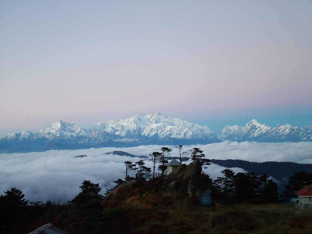
The Four 8,000ers You Can See From Eastern Nepal
Four of the five highest mountains on earth stand along the eastern Himalaya of Nepal: Everest, Kanchenjunga, Lhotse and Makalu. …
 practical
Getting to Eastern Nepal: Flights, Roads, Borders
Fly from Kathmandu to Bhadrapur for Ilam, Sandakpur and Kanchenjunga, to Biratnagar for Dharan, Dhankuta, Hile and Koshi Tappu, and …
 planning
Ilam Tea Country: Gardens, Flushes and Where to Go
Ilam is Nepal's oldest tea district, with its first estate planted in 1863. Fly to Bhadrapur and drive 3–4 hours …
 permits
Kanchenjunga Trek: Routes, Permits and Stages
The Kanchenjunga trek needs a restricted area permit, a Kanchenjunga Conservation Area permit, a registered agency, at least two trekkers …
 culture
Kirat Culture: The Rai and Limbu of the East
Kirat is the shared name for the Rai, Limbu, Yakkha and Sunuwar peoples of eastern Nepal. Their faith rests on …
 trekking
Makalu Base Camp and the Barun Valley
The Makalu Base Camp trek starts at Tumlingtar in the Arun valley and climbs over Shipton La into the Barun …
Far West & Karnali
 wildlife
Bardia National Park Safari Guide
Bardia is Nepal's largest lowland national park, 968 km² of sal forest, grassland and Karnali river channels, and one of …
 culture
Deuda and Gaura: The Culture of the Far West
Deuda is the call-and-answer song and circle dance of Nepal's far west, sung by two groups who trade verses for …
 seasons
Best Time to Visit Far West Nepal, and the Flight Problem
October and November are the best months for almost all of Far West Nepal, with March to May next. Bardia …
 food
foodFar West Food: Red Rice, Apples and Millet
Far West food is the food of two worlds. In the Karnali hills: Jumla's red marshi rice, apples, beans and …
 practical
Getting to Far West Nepal: Flights and Roads
Almost every trip to Far West Nepal starts with a flight from Kathmandu to Nepalgunj or Dhangadhi on the plain. …
 permits
Humla and Limi Permits: Restricted Area Rules
Upper Humla, including the Limi Valley and the trail from Simikot to Hilsa, is a restricted area. At the time …
 stories
The Khasa Malla Kingdom: Nepal's Forgotten Empire
From about the 12th to the 14th century, the Khasa Malla kings ruled a Himalayan state from the Sinja valley …
trekkingRara Lake Guide: Getting There, Trekking and Seasons
Rara is Nepal's largest lake, 10.8 km² at 2,990 m in Mugu district, inside the country's smallest national park. Reach …