Asoj 2083 BSअसोज २०८३· Nepal runs on its own calendar

Eastern Nepal · valley

Tumlingtar

तुम्लिङटार

Tumlingtar is a small airstrip town on a wide, flat river terrace (tar) between the Arun and Sabha rivers in Sankhuwasabha district, at about 500 m. It is the gateway for the Makalu Base Camp trek and the hill towns of Khandbari and Chainpur. Most travellers pass through in a few hours, but it rewards a slower day.

  • Stay 0–1 nights
  • Best Oct – Mar
  • चुरेChure and Inner Terai
Tumlingtar
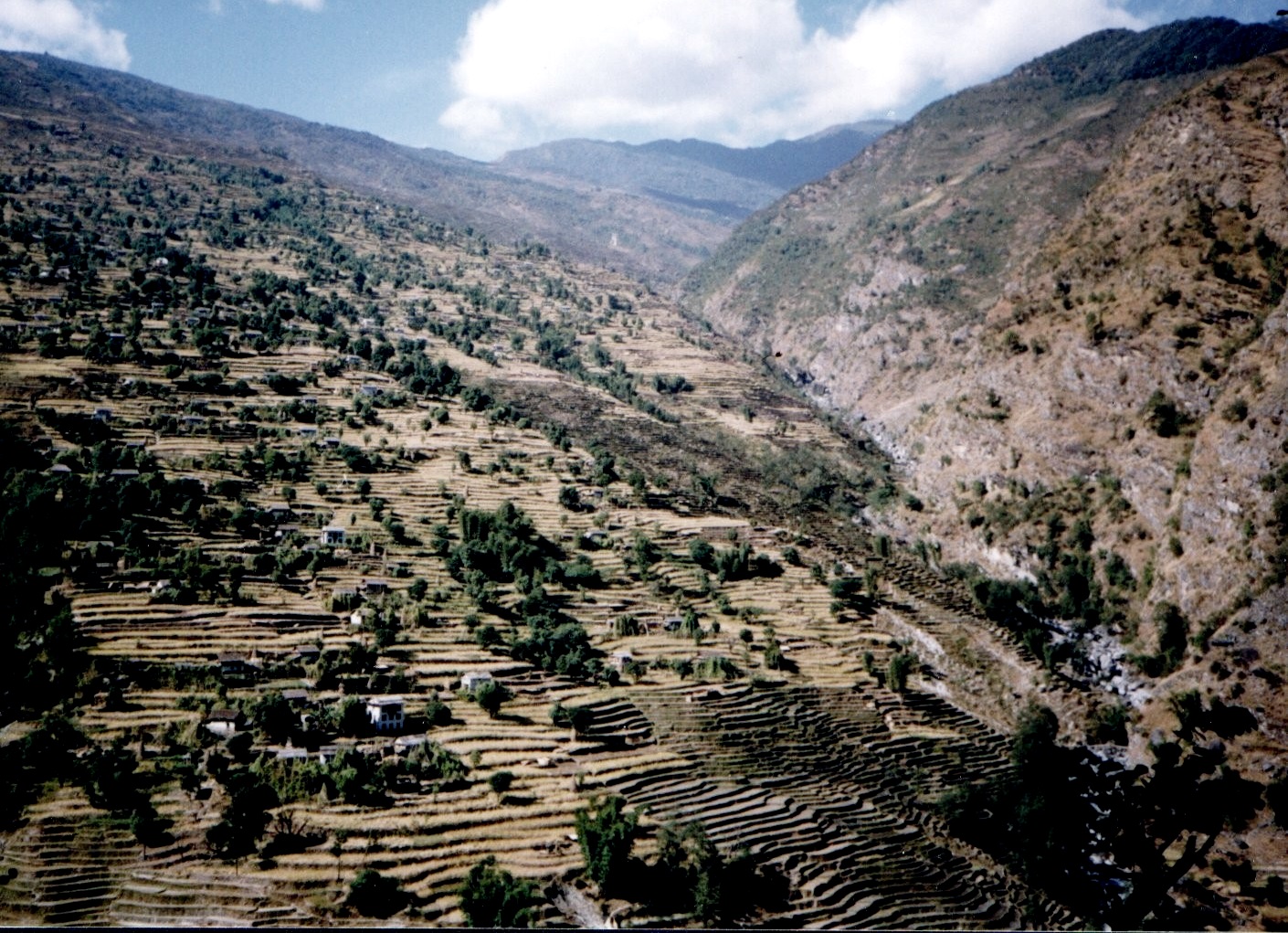
Photo: Rajesh Dhungana · CC BY-SA 4.0, Wikimedia Commons

The air at Tumlingtar

Altitude518 m5.9% of the way to 8,849 m
BeltChure and Inner Teraiचुरे · The first hills and the river valleys behind them
Each breath94%of the oxygen at sea level
Water boils98.2 °Cso dal takes longer here
vs Kathmandu+5.7 °Ctypical difference by height

Oxygen, boiling point and temperature are worked out from the standard atmosphere for 518 m; real days vary with weather.

Fly into Tumlingtar and the first surprise is the heat. The plane lands on a long, level terrace high above the Arun river, among fields, mango trees and scattered houses, with forested hills rising on every side. It feels more like the edge of the plains than the gateway to an eight-thousand-metre peak. Yet Makalu, the fifth highest mountain on earth, stands only a few days' walk to the north, hidden behind the ridges.

The town is spread along the road from the airstrip. There are lodges, tea shops, jeep counters for Khandbari and Num, and offices tied to the hydroelectric projects being built on the Arun. Trekkers usually land in the morning and drive off toward Makalu the same day, and the town sees them only for an hour or two. On the way back, tired and happy, many wish they had planned an extra night here.

If you have time, stay a night. Walk to the edge of the tar for the view down to the Arun, eat a proper Rai meal, and drive up to Khandbari or across to Chainpur, the old bazaar of brass and bronze casters. In winter, when the hills are cold, Tumlingtar's mild days and warm evenings make it a pleasant base, and the light over the river in the late afternoon is lovely.

Why go

The edge of the tar

Walk 20–30 minutes from the airstrip to the edge of the terrace for the view down to the Arun river, wide and grey-green in winter, brown in the monsoon, with forested ridges rising beyond.

Gateway to Makalu

Tumlingtar is where the Makalu Base Camp trek begins for most trekkers. Jeeps leave from here for Khandbari and on toward Num and Seduwa, a long day on rough road through the hills of Sankhuwasabha.

Khandbari bazaar

The district headquarters of Sankhuwasabha sits on the ridge above Tumlingtar, about an hour by road. Its bazaar serves the whole district and is a good place to stock up before the trek.

Day trip to Chainpur

The old bazaar town of Chainpur, known for its karuwa water jugs and brass and bronze casting, is a drive of a couple of hours from Tumlingtar, with stone-paved lanes and old Newar houses.

Warm winter days

At around 500 m Tumlingtar is warm when the hills are cold. From November to February days are mild and sunny, a pleasant contrast to the high country, and a good place to rest after Makalu.

१The story of Tumlingtar

A tar between two rivers

In Nepali, a tar is a raised, flat terrace above a river, made of old river gravel, and Tumlingtar is one of the largest in the country. Its flat land and warm climate made it good farmland for rice, maize and fruit. In Nepal's Fourth Plan of the early 1970s it was chosen as the site of an airstrip to serve the far-off districts of the Koshi hills, which had no roads and could be reached only on foot over many days.

For decades the airstrip was the only quick way in or out of Sankhuwasabha. Porters carried goods from the planes up to Khandbari, Chainpur and the villages toward Makalu, and the trails out of town were busy with loads of rice, salt, kerosene and cloth. Roads from Hile and the south arrived later and changed the town again, with jeeps and trucks taking over much of the carrying, and Tumlingtar became a road junction as well as an airport town.

Tumlingtar's newest chapter is water. The Arun is one of the great rivers of Nepal, rising in Tibet and cutting through the Himalaya, and hydroelectric schemes have been planned and built along it for years. In the 1990s an earlier Arun III scheme became the first case brought to the World Bank's new Inspection Panel, and the Bank later withdrew. A 900 MW Arun III plant has since been under construction by India's state-owned SJVN under an agreement with Nepal.

३The people

Who lives here

Tumlingtar and the surrounding Arun valley are home to Rai families of several Kirat groups, alongside Brahmin, Chhetri, Newar, Gurung, Tamang, Sherpa and other communities. Farming of rice, maize, millet and fruit is the main living, along with shops, transport, government work and jobs on the hydro projects. Many households have members working in the Gulf or Malaysia.

४Words you will hear
Nepali
टार
tar

Raised flat river terrace, as in Tumlingtar

Nepali
बेसी
besi

Warm lowland valley floor by a river

Nepali
भरिया
bhariya

Porter who carries loads on the back with a head strap

Every word on this site

५What to eat

Wachipa

A Kirat Rai dish of rice cooked with minced chicken and a powder of burnt chicken feathers, which gives it a smoky, bitter taste. It is made for special occasions rather than daily meals. We ask a Rai family or lodge kitchen near Tumlingtar to prepare it with notice.

६Few people know

Things most guides leave out

Tumlingtar Airport sits at about 518 m on the flat terrace between the Arun and Sabha rivers, and was first conceived in Nepal's Fourth Plan to serve inaccessible areas of the eastern hills.

Wikipedia: Tumlingtar Airport

The earlier Arun III hydropower plan was the first case submitted to the World Bank's Inspection Panel in 1994, and the Bank withdrew from the project in 1995.

World Bank Inspection Panel, case 1: Nepal Arun III

The Arun river rises in Tibet and cuts south through the main Himalayan range before joining the Sapta Koshi, making it one of the rivers older than the mountains it crosses.

Wikipedia: Arun River (China–Nepal)

Untold Nepal, region by region

Getting there

How to reach Tumlingtar

Air

Flights from Kathmandu to Tumlingtar take about 45 minutes. Schedules vary by season and are often delayed or cancelled by cloud, especially in the monsoon; check current status before you travel.

Road

From the Terai, the road climbs from Itahari through Dharan, Dhankuta and Hile to Khandbari and Tumlingtar, about 10–14 hours by jeep or bus. From Kathmandu, allow two days by road.

Where to stay

Tumlingtar has simple lodges and small hotels near the airstrip, used by trekkers, officials and hydro workers; expect clean rooms, fans and basic bathrooms, and simple restaurants serving dal bhat and noodles. Khandbari, about an hour uphill, has more choice and cooler nights. For trekkers heading to Makalu, we usually drive straight on toward Num or Seduwa, or spend the first night in Khandbari.

Local tips

  • Fly in the morning; cloud often builds over the hills in the afternoon and flights can be cancelled.
  • Expect heat from April to September; carry water and sun protection on the tar.
  • Book jeeps through us or your lodge; seats to Num and beyond fill up fast in October.
  • Stock up on cash in Khandbari or Kathmandu before the Makalu trek; ATMs are limited and can be offline.
  • Keep a spare day in any itinerary that depends on Tumlingtar flights.

On the map

Tumlingtar and what is near it

Map of Tumlingtar, Chainpur, Makalu Base Camp, HileIndiaChinaNepalKoshiTumlingtar1TumlingtarChainpur2ChainpurMakalu Base Camp3Makalu Base CampHile4Hile50 kmN
  1. 1Tumlingtar
  2. 2Chainpur
  3. 3Makalu Base Camp
  4. 4Hile
Drawn by Book Nepal Trip from Natural Earth outlines (public domain). International borders as depicted by Nepal. Rivers: Karnali, Gandaki and Koshi systems. Not for navigation.

Questions

Tumlingtar: what travellers ask

Where is Tumlingtar?

Tumlingtar is in Sankhuwasabha district, Koshi Province, eastern Nepal, on a flat terrace between the Arun and Sabha rivers at about 500 m. It is about an hour by road below Khandbari, the district headquarters, and is the main airport for the Makalu region.

How do I get to Tumlingtar from Kathmandu?

Fly from Kathmandu to Tumlingtar in about 45 minutes, or travel by road via the East–West Highway, Itahari, Dharan, Dhankuta and Hile in about two days. Flight schedules vary and weather delays are common; check current status before you travel.

Is Tumlingtar the start of the Makalu trek?

Yes, for most trekkers. From Tumlingtar, jeeps drive via Khandbari toward Num and Seduwa, where the walk to Makalu Base Camp begins. Road heads are moving as roads improve, so check current status before you travel.

What is there to do in Tumlingtar?

Walk to the edge of the terrace and down to the Arun river, explore the farm villages on the tar, eat Rai food, and take trips to Khandbari bazaar and the old casting town of Chainpur. It is a quiet place for a night.

What does tar mean in Tumlingtar?

A tar is a raised, flat river terrace in Nepali, made of old river deposits. Tumlingtar is one of the largest in Nepal. Other places named with tar, such as Bhedetar in Dhankuta, describe similar flat land.

When is the best time to visit Tumlingtar?

October to March is best: dry, clear and warm by day. April to June gets hot, and June to September brings monsoon rain, cloud and frequent flight cancellations. For Makalu treks, aim for October–November or April–May.

Are there hotels in Tumlingtar?

Yes, simple lodges and small hotels near the airstrip, with basic rooms, fans and bathrooms. Khandbari, an hour uphill, has more choice and cooler nights. Neither has international chain hotels, and we book places we have checked recently.

How far is Chainpur from Tumlingtar?

Chainpur is a drive of roughly 1.5–2.5 hours from Tumlingtar, depending on the road and route. It makes a good half-day or full-day trip, or a night stop on a slower Arun valley itinerary combined with Khandbari.

Is there a road from Tumlingtar to Dharan?

Yes. The road runs from Tumlingtar via Khandbari, Hile, Dhankuta and Bhedetar down to Dharan and the Terai. It is paved in long sections, but landslides can cause delays in the monsoon. Check current status before you travel.

Plan with a local planner

Tell us your height, we will find the trail

Easy hills or a 5,000 m pass, a week or a month: three short questions and a planner sends a first plan, with the sleeping height of every night and an itemised price.

  1. १Tell us where, when and how high you want to go
  2. २Get a first plan and an itemised price within one working day
  3. ३Change anything until it fits. Pay a deposit only when you book
Plan my Nepal trip